The inspiration struck while riding an Amsterdam tram. I wondered how fast we were moving, our exact elevation relative to sea level, and just how flat the Netherlands really is. I wanted a clean, native tool to track telemetry and record routes—built with complete privacy and zero clutter.
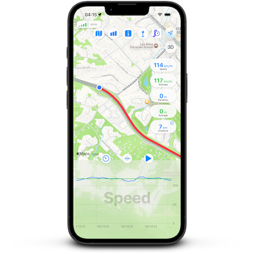
Track current speed, real-time elevation, and total trip distance at a glance. Supports both metric (km/h, metres) and imperial (mph, feet) units. Interactive charts plot how your speed and altitude fluctuate across the entire duration of your trip.
Export your recorded routes as standard .gpx files anytime to import into maps, fitness apps, or my GPX Mapper app. Files stay stored purely on-device. No accounts, no logins, and zero remote tracking.
Record smooth route logs even while your screen is locked. To conserve battery when you only want a quick glance, you have full control: tap the pulsing status icon to pause background updates instantly, and tap again to resume.